
A Dancer’s History of River Falls Lodge, by Jennie Wakefield
In June 1995, Harvest Moon Folk Society held its first contra dance at River Falls Lodge in northern Greenville County, SC. The band was Haphazard Ensemble (Laurie Fisher, Julia Wetherford, Karen Gaughan, Beth Magill) and the caller, Beth Molaro. Beth remembers it as “a magical dance in a magical place reawakening the spirits of dancers past.” I was there that night, and the Lodge has figured into my life ever since, including as the setting for one daughter’s wedding. The Lodge does have a certain magic, as if at any moment you could walk through the door into an alternate universe. I have been under the influence of its magic long enough that I decided to do some research to shed light on my imaginings and to verify the bits and pieces of history I’ve heard.
I’m grateful for two major sources, a memoir by Elzy Kathleen Nelson, and a history by Mann Batson, local historian. I interviewed a number of other individuals, to whom I am most appreciative. Jimmy Smith, an employee at the Greenville County Library and a contra dancer, searched out several old documents. Thanks also to Laurel Horton for excellent feedback.
First Nations
The explorer Hernando de Soto and his expedition first made contact with the Cherokee in the mountains of South Carolina around 1540 (“Cherokee”). In 1767, South Carolina and North Carolina negotiated with the Cherokee to create a boundary between new settlements to the east and Indian land to the west. In South Carolina, that line ran north from what is now Honea Path, crossed the Reedy River near what is now Princeton, and ended at the border of South Carolina and North Carolina (“Historic Markers”).
In her memoir set in the area on the Middle Saluda River in northern Greenville County, South Carolina now known as River Falls, Kathleen Nelson, descended from settlers of the area, recalls stories told by her grandmother about the Cherokee origin of the name Oil Camp Creek and present day Oil Camp Creek Road. Indians hunted and camped by the creek, and on the creek’s edge was a dark scary cave that extended far into the mountainside of Pinnacle Mountain. Near the front of the cave was a large flat rock, possessing a long deep groove, which extended outward from the cave. When the Cherokees cooked their wildlife, mostly bear, the oil from the meat ran down the long deep groove and flowed into the creek, thus the name Oil Camp Creek. (22)
The Saluda River got its name from the Saluda Indians, who came through the area between 1695 and 1712. They were a small band of Shawnee that migrated south from Pennsylvania, probably to trade with the Spaniards in Florida. They returned to Pennsylvania but their name remained on the river and other locations in the Carolinas (Vandergrift).
Roads In and Out
The boundary line between Cherokee territory and white settlement did not prevent colonists from crossing into Indian territory. The Potts family settled in the River Falls area and for a while the area was known as Potts Cove. A trading post stood near the present day Jones Gap State Park trailhead (Nelson 21, 48).
In 1777, the Cherokee ceded almost all their territory in South Carolina. By 1790, new settlers, as many as 16,000, had moved into the region (“Cherokee”). New roads in upper Greenville County were authorized by the legislature in the early 1800s (Nyland 1). By the mid-1800s, people needed an efficient way to move livestock and produce between Greenville, South Carolina and Transylvania County, North Carolina. Low country tourists sought the climate of the upcountry in summer and needed adequate roads (8).
In 1852, Solomon Jones and other residents of River Falls formed a company and petitioned the legislature to build a road that would run along the Middle Saluda River to Greenville (Nyland 2). Jones, a tall man of Welsh descent and a staunch Unionist, was born in Hendersonville, North Carolina in 1802 and had moved to Oil Camp Creek as a child with his family, married, and remained in the area. He and his wife Mary lived in a farmhouse on Oil Camp Creek Road. He was called “The Road Builder” despite his lack of formal engineering training.
Legend has it that Jones laid out the Jones Gap Road through the dense mountain valleys – now the hiking trail through Jones Gap State Park – by following the path scouted by his sow. He wielded an axe in one hand and held the animal’s tail in the other. Solomon built other roads too, but this one was especially well engineered – scenic, crooked, but with “a gradual climb” that was easily traveled (Nelson 10-11). It took Jones and his crews ten years to build (Nyland 4). Jones set up toll gates at both ends of the road, the lower end at River Falls and the upper end in Cedar Mountain (Nelson 10). The legislature set the toll fees for portions of roads not maintained by the state (Nyland 6).
In 1862, the legislature recommended that the state discontinue maintaining any part of the Jones Gap Company’s road because the road was not wide enough to fit the definition of a turnpike, because of the expense to remedy this, and because the toll road further up benefitted the Jones Gap Company (Nyland 6).
In 1869, the company requested a recharter stipulating that the company would maintain the eight miles from Oil Camp Creek Road to the top of the mountain near the North Carolina line. This mountainous section is considered the Jones Gap Road. It required constant work to keep up the many bridges. Solomon Jones died in 1899 and the Jones Gap Road operated as a toll road until about 1909 (Nyland 3-5).
The name River Falls refers to an impressive waterfall formed by Falls Creek north of Duckworth Road. It is visible from several locations around the area (Nelson 47). Ducworth Road is between River Falls Lodge and Jones Gap State Park.
Elzy Cox, the husband of Nora Hart, who was a granddaughter of Solomon Jones, built the winding part of Oil Camp Road in the early 1900s using knowledge he learned from Solomon. The road ends just below Caesar’s Head (Nelson 35).
Gap Creek Road began at River Falls Road and terminated in the hills at Green River in North Carolina (58). Later it connected to U.S. 25, which became a four-lane expressway in 1973, making Gap Creek less remote (aaroads). Larry Epps – who grew up in Dacusville, South Carolina in the 1950s and ‘60s – recalls that before Gap Creek Road intersected Highway 25, there was a store not far from the intersection with River Falls Road, run by Ruby Barton, that sold beer on Sundays. As a teenager, Larry and his friends would go there on Sunday afternoons, sitting in cane-back chairs around the edge of the room. Local musicians jammed on fiddle and banjo and people clogged. No one got out of line, he said, because Ruby kept a baseball bat.
Inns and Other Enterprise
River Falls stirred with enterprise in the late 19th century and into the 20th. In 1885, C. G. Drake came through the area, married, and built the Drake Inn across River Falls Road from Ducworth Road. The inn hosted commercial traffic, including revenuers and drovers as well as summer tourists (Batson 142-3). Nelson describes the Drake’s “renowned splendor” as “picturesque.” Guests might spend the entire summer, coming back each year.
The main house had two levels and a porch across the front with rocking chairs (Batson 46). The kitchen was attached to the main house and the cooking was done in a huge fireplace. The main floor had a parlor, dining room, and pantry, as well as two bedrooms. The second floor had six bedrooms. On the back porches of both floors, sinks ran with cold water that operated by “gravity flow,” says Batson (142-3). The water came in through a pipe from higher ground and the spigot was left to drip (Nelson 39).
The Drake family raised their own fruits, vegetables, and meats, and hunted and fished to provide food for the guests. Meals were served on a huge dining room table, family style. There was a smokehouse with a cold water trough running through it where meat was cured, and produce and dairy products stored. The inn had pens, barns, and feed for the livestock of travelers and drovers (Batson 142-3).
The Drake property also had a two-story dance hall. The first floor was open air so was used for dancing only in good weather. Upstairs were 12 more guest rooms. Sometimes the music was from a Victrola, which had to be wound up by hand (Batson 142-3).
The public was invited to swim free of charge in the Drake’s swimming lake, which Mr. Drake created by damming the river. It was six to eight feet deep in some places, with a rope swing and a sandy beach on an inside bend. Batson writes that the Drakes also had a store and a surrey line to take travelers on to Caesar’s Head via the Jones Gap Road (144).
Between 1910 and 1914, the Swamp Rabbit train ran intermittently between Greenville SC and River Falls (abandonedrails.com). Nelson says the railroad line was completed to River Falls in 1908 (44). The train crossed the river at Dead Man’s Curve – which is near River View and Jennings Mill Road, about a mile from the F-Mart – traveled along the side of the river, then turned into the woods on its way to the River Falls depot. The depot was located across Gap Creek Road from where the fire station is now, at the corner with River Falls Road. The concrete piers of the crossing can still be seen near Dead Man’s Curve, and decayed cross ties and long iron spikes can be found in the woods (32). The train’s “turn table” was near the intersection of Gap Creek and River Falls Roads “in the Cantrell’s fields” (44).
Nelson writes that tourists, especially young men, often took the Swamp Rabbit train to River Falls and traveled up Jones Gap Road, sometimes on foot, to Caesar’s Head for the Saturday night dances. Arriving there in time for supper, they stayed for the dance at the hotel (built in 1851, according to Judith Bainbridge), and returned home on Sunday (Nelson 36-7).
Robert West took over the Drake Inn and operated it between 1915 and 1919. In 1917, he built another inn, the Valley View, across River Falls Road at the corner of Ducworth Road, says Batson. It had three levels and 17 rooms. There was a downstairs porch and a second floor porch that wrapped around the house, with bathrooms on the first and third floors. It was heated by one wood heater in the living room but was not fully occupied in winter. It had electric lights, an ice room, and excellent food (141-2). The hotel burned in 1942 (Nelson 47).
The state took over maintenance of River Falls Road at some point prior to 1921, but the mountainous section remained unpaved (Nyland 7). When a highway was proposed from Greenville to Caesar’s Head, many people wanted it to follow the Jones Gap Road. It was decided in 1932, however, to route Highway 276 away from Jones Gap (Nelson 79). In time, Jones Gap Road reverted to a winding trail, now the hiking trail through the state park. As Nyland points out, “Closure of the road to automobile traffic played a large part in preserving this wilderness area for today” (8). We can only imagine how different River Falls would be had Highway 276 been routed along Jones’ road.
In 1931, the Cleveland State Fish Hatchery was built on 20 acres of what is now Jones Gap State Park for the purpose of raising rainbow trout to stock the mountain streams (71). The natural beauty of the surrounding area was left undisturbed in the interest of drawing tourists. The superintendent was J. Mays Nelson, and his wife Grace was a great granddaughter of Solomon Jones (Nelson 72-4). The family lived on the grounds in a log house. Because the hatchery was open to the public seven days a week, activity and traffic in the River Falls area was heavy, especially in warm weather (52, 77). It operated until 1963 (113).
In the early decades of the 2oth century, local children attended a one-room schoolhouse, Salem School, on Oil Camp Creek Road (Nelson 22) and another on Gap Creek Road. Some graduates went on to Six Mile Academy in Six Mile, SC, North Greenville College, Clemson, Wofford, or Converse (54-5, 58). Local residents attended Gap Creek Church, established on land deeded in 1840 and rebuilt or renovated over the years (63).
Families and individuals also left the area. Many went west in the late 1800s encouraged by the Homestead Act of 1862 (Nelson 40). Residents fought in both world wars (27). Later residents worked at the lumber mill, which stood where the Cleveland post office is now, or at Slater Mill in Marietta (Townes).
In the 1940s and ‘50s, after the railroad and inns were gone, people from Greenville built summer homes and cabins at River Falls. The swimming hole near the intersection of Ducworth Road and River Falls Road, where the Middle Saluda curves sharply and near where the Valley View once stood, was a draw. To the right of the swimming hole was a log pavilion used for square dancing. Music was from a juke box and dances were called by a caller. The wooden floor was sprinkled with corn meal to make it easier to dance on. A store stood across the road where people could get snacks (Nelson 51).
The lumber mill closed around 1958 (Chambers), and in the early 1960s, a group of developers created an amusement park on the site, Echo Valley, but it was short lived. Patterned after an amusement park in Maggie Valley, North Carolina, it had a western theme, including a train ride from Marietta to Echo Valley on which was staged a gunfight (Townes).
Around 1955, local residents asked the state to rework the neglected part of Jones Gap Road beyond the hatchery, but this did not happen. Then in 1959, a flood and landslide isolated the hatchery, killing fish and damaging roads and bridges. The hatchery closed in 1963 (Nelson 113).
In 1976, the state began to acquire property to preserve the mountain wilderness and protect it from development. Jones Gap State Park opened in 1989 (Bainbridge), and the Jones Gap State Park visitor’s center was built in 1991 on the site of the superintendent’s log house. The paved road now ends at the park. Solomon Jones’ road is now the hiking trail through the park (Nelson 117).
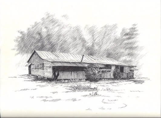
River Falls Lodge
River Falls Lodge was built in the 1950s by Lowell and Jane Tankersley, who had roots in the area. Prior to that, it had been a pasture. The Tankersleys held square dances there on weekends. One of Lowell’s brothers was the caller. Lowell built a large swimming pool in the field beside the lodge and visitors swam for free (Nelson 52, McGee, Poole).
The dances were popular. It wasn’t uncommon to have 350 people present on a given night, but not all danced at once. For crowd control, arm bands were issued at the door. There were 175 red and 175 white arm bands. Red did two dances, white did two, then back to red. Dancers traded bands if they wanted to sit out or dance more (Reed, Burns).
Contra dancer Roger Burns was told by his father, who lived in Travelers Rest, that the Lodge was a “rough-and-tumble” place and that he was “careful not to go alone and to be sure his intentions toward the ladies were not misunderstood.” Larry Epps, from Dacusville, says his parents did not allow him to go to the Lodge as a teen because there was drinking, but once when he was 18 or so, he did go, staying only a short time in case anyone should see him and tell his parents. He remembers the dances as couples dances and was careful not to “cut in” because the girls’ dates would not have taken kindly to it.
Later, the Lodge was used as a community hall by groups who wanted a mountain dance hall for a social, including college students from Greenville, one of whom was John Duggan, now a Greenville attorney and an initial organizer of Harvest Moon Folk Society. As a Furman student, Duggan played bass in a swing band at River Falls.
Nelson describes that era as having “an exciting, romantic and mysterious quality.” It was “a special nostalgia” to those who lived there then (52). She points out that the entire area from Highway 276 to the North Carolina line is known as River Falls – “an area that encompasses communities once known as River View, Jones Gap, Gap Creek, Oil Camp Creek, as well as River Falls.” Yet the name is not noted on maps, nor can it be ascertained on a map (52).
Leon Chapman and Harvest Moon Folk Society
Around 1985, Leon Chapman had a cabin in the River Falls area and began using the Lodge for storage, leasing it with an option to buy (Reed). The deed was transferred to him on December 12, 1995 (Ownership). Chris Bueker describes more about how Harvest Moon came to be at River Falls in “A Short History” elsewhere on the Harvest Moon website.
Leon kept the name River Falls Lodge and the rusty sign identifying it, respectful of the patina of time. He had the swimming pool filled in and grassed over for safety reasons.
When I first began dancing at Slater Hall, Leon was a favorite partner of mine. He always smelled of talc, wore his gray hair neatly combed back in a ponytail, and had Popeye arms with tattoos before tattoos were common. He walked and danced with a limp, due to a wreck years before. While driving on one of the country roads, he collided with a school bus. I don’t believe any children were hurt, but Leon had both hips replaced. Maybe as a way of coming to terms with this, he collected school buses. There are still several of them out behind the lodge. He had planned to have them outfitted for people to stay in after the dance – like a bus hotel. Leon died in 2005. Scott McCall inherited the lodge from Leon.
I stopped in at the F-Mart recently to ask if anyone there could answer a question about the Lodge’s history. John McCarson, sitting on a stool at the back of the store, listened respectfully to the background of my question, and gave me contact information for his 88-year old sister, Betty McCarson Poole, who he thought could help. As I drove on towards River Falls, I noticed McCarson Road not far from the store.
Works Cited
AARoads.com – U.S. Highway 25. www.aaroads.com. Accessed June 18, 2016.
Abandonedrails.com/Greenville_to_River_Falls. Accessed June 5, 2016.
Bainbridge, Judith. www.caesarsheadshowcase.com/history. Accessed June 17, 2016.
Batson, Mann. Early Travel and Accommodations Along the Roads of the Upper Part of Greenville County, South Carolina and Surrounding Areas. An Original Publication. Taylors SC: Faith Publishing Company. 1995.
Burns, Roger. Email. March 26, 2011.
Chambers, Gary. “Memories of the Steam-Powered Sawmill.” www.farmcollector.com. Accessed June 17, 2016.
“Cherokee People,” www.palmettohistory.org. Accessed June 26, 2016.
Duggan, John. Telephone interview. March 26, 2012.
Epps, Larry. Telephone interview. June 6, 2016.
“Historic Markers Across South Carolina.” www.lat34north.com. Accessed June 25, 2016.
McGee, Emma Lou (b. 1935). Telephone interview. June 14, 2016.
Molaro, Beth. Email. January 14, 2012.
Nelson, Elzy Kathleen. As the Crow Flies: The Saga of Nora Hart. LaVergne, TN: Xlibris, 2008.
Nyland, R.C. Department of Parks, Recreation, and Tourism, Division of State Parks. “Working Paper – Draft, Jones Gap Turnpike Road.” April 16, 1991, September 10, 1991.
Ownership History. Gegis.org/webmappub/parcelhistory.aspx.
Poole, Betty McCarson (b. 1928). Telephone interview. June 15, 2016.
Reed, Weogo. Email. March 27, 2012.
Townes, Laura. Interview. June 13, 2016.
Vandergrift III, Roy and William S. Taylor, Sr. www.scgen.org/path. Accessed June 15, 2016.